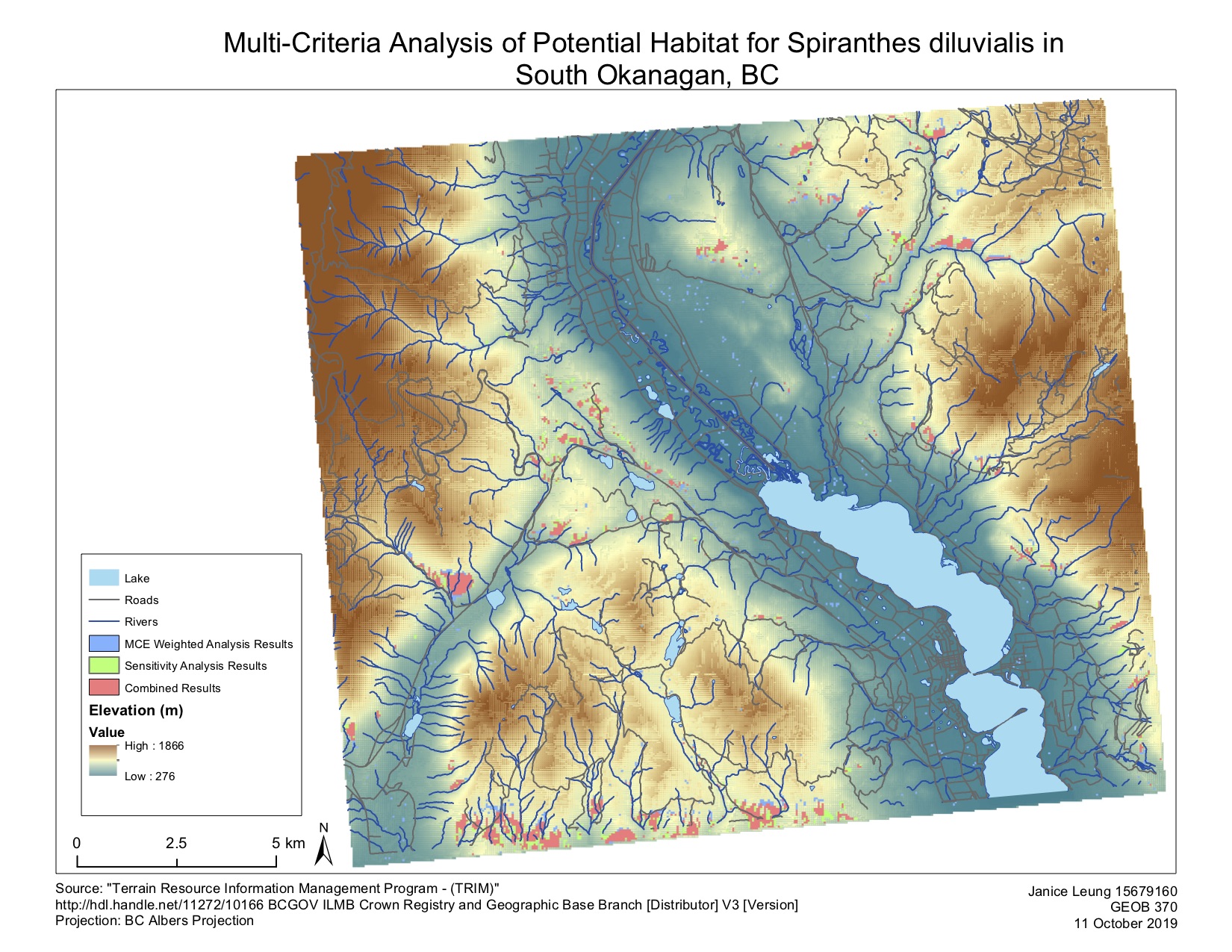
I have been tasked to write a report on a rare plant species, Spiranthes diluvialis, for a botanist to help her with her field work. The botanist has identified that this plant species prefers a low-slope, mid-low elevation area with a southern aspect. Using this knowledge, I have produced a multi-criteria model to map out ~700+ hectares that are most likely support the habitat for this plant species.
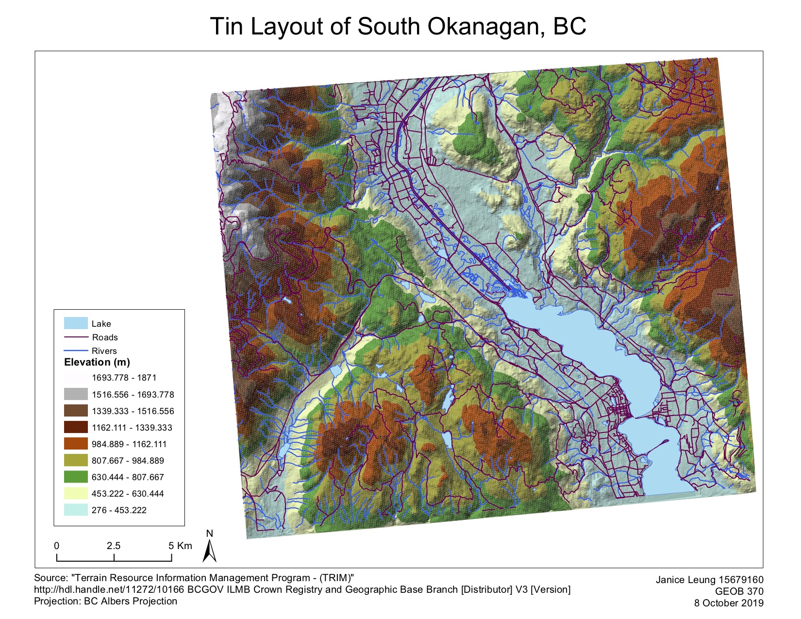
I first downloaded the TRIM data from the BC government to create a TIN which recreates the topographic surface of the southern Okanagan, taking into account elevation point data, rivers and lakes and roads. A raster-based digital elevation model is then created from the TIN. The DEM provides the basis to create out other factors, slope and aspect. Knowing the elevation, slope and the aspect of South Okanagan, I moved on to map out the potential habitat of Spiranthes diluvialis.
As noted in the literature review, I know that Spiranthes diluvialis prefers a low-slope, mid-low elevation area with a southern aspect. Before carrying out any analysis with the data, I first normalized the elevation, the slope and the aspect data by using the fuzzy membership tool with 0 as the least favourable and 1 as the most favourable. In this way, I can then compare the values and determine their weights. In order to determine their weights (their relative importance), I use the website http://www.123ahp.com/Default.aspx to calculate the AHP weights. The AHP website calculates and ranks the weights of the elevation, the slope and the aspect of the set of data. This contributes to the MCE weighted analysis result as highlighted in navy blue on the map and also in the table below .
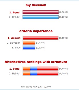
Fig. AHP analysis result
The sensitivity analysis is of which all three factors are weighted equally and the combined results are the results where the mce weighted analysis and the sensitivity analysis are overlapped. The combined results is the most accurate potential habitats as they are determined to be favourable despite fluctuations in weight.
| Type of analysis | Total approximation area (ha) |
| Weighted Analysis | 203 |
| Sensitivity Analysis | 200.5 |
| Combined Results | 514 |
Skills I Learnt Through This Assignment
- Create a Triangular Irregular Network (TIN) and Digital Elevation Model (DEM) using BC TRIM data to analyze the topography of the area of focus.
- Conduct a multi-criteria evaluation (MCE) analysis to determine the potential habitat for Spiranthes diluvialis in southern Okanagan, BC.
Learning Significance