Sea Level Rise
This week I was tasked to map how different extents of sea level rise would affect Vancouver Coastal Region.
UBC Geography Student
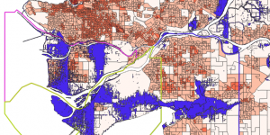
This week I was tasked to map how different extents of sea level rise would affect Vancouver Coastal Region.
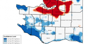
In the final project, our group conducted a hotspot analysis to analyze the Vancouver Crime data.
In this assignment, I was tasked to conduct a Vancouver Crime Analysis for the Canadian Government.
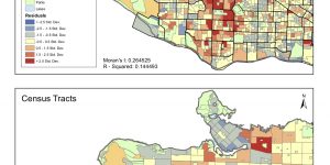
Potential Habitat Analysis for Spiranthes Diluvialis
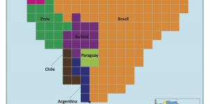
In this assignment I was tasked to make a cartogram of South America's countries proportion to their forest areas in 2016.
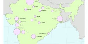
The above maps are proportional symbol maps of major cities in India in two different methods - absolute scaling and perceptual scaling.
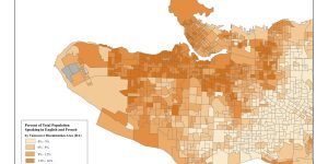
This week I created a choropleth map of English and French speakers in Vancouver by using 2011 Canadian Census data.
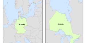
Different map projections preserve different aspects of the map. In this assignment, I made maps of Ontario and Germany on ArcMAP based on the Albers equal area conic projection.
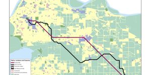
In the following assignment, I was tasked to create two pathways for a hypothetical new marijuana greenhouse in Surrey and Langley BC.
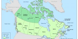
I was tasked to make a reference map of Canada for a Grade 5 social studies textbook. In this assignment, I learnt how to use Adobe Illustrator to create different map elements such as a scale bar, north arrow.