Sea Level Rise
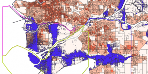
This week I was tasked to map how different extents of sea level rise would affect Vancouver Coastal Region.
Advanced GIS: Final Project
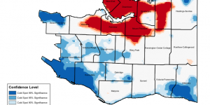
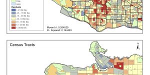
In the final project, our group conducted a hotspot analysis to analyze the Vancouver Crime data.
Advanced GIS: Vancouver Crime Analysis
In this assignment, I was tasked to conduct a Vancouver Crime Analysis for the Canadian Government.
Advanced GIS: Potential Habitat Analysis for Spiranthes Diluvialis
Potential Habitat Analysis for Spiranthes Diluvialis
Cartography: Cartogram of South America
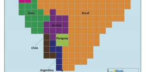
In this assignment I was tasked to make a cartogram of South America's countries proportion to their forest areas in 2016.
Cartography: Proportional symbol Map of population in India
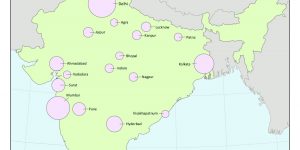
The above maps are proportional symbol maps of major cities in India in two different methods - absolute scaling and perceptual scaling.
Cartography: Population of Non-Canadian-official-language Speakers
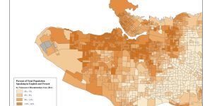
This week I created a choropleth map of English and French speakers in Vancouver by using 2011 Canadian Census data.
Cartography: Comparing Projections
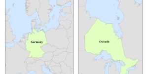
Different map projections preserve different aspects of the map. In this assignment, I made maps of Ontario and Germany on ArcMAP based on the Albers equal area conic projection.
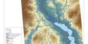
Advanced GIS: Least-Cost Pathway for Marijuana Greenhouse
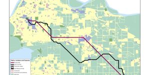
In the following assignment, I was tasked to create two pathways for a hypothetical new marijuana greenhouse in Surrey and Langley BC.
Cartography: Canada's Provinces and Territories
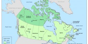
I was tasked to make a reference map of Canada for a Grade 5 social studies textbook. In this assignment, I learnt how to use Adobe Illustrator to create different map elements such as a scale bar, north arrow.
Professional Development Reflection
Reflection on the Geob 270 course and how it equips me in future
Final Project: Central Line: Determining Potential Ridership and the Accessibility to the Skytrain for Surrey and the Langley's Residents and Schools
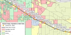
This project will explore the 'ridership success for the residents of Surrey and the Langleys, and will look at how an extension to this approved line into the Township of Langley will prove beneficial to the growing population of the lower Fraser.
Lab 5: Environmental Impact Assessment: Brohm Ridge Ski Resort Project
This map provides an analysis of the proposed Garibaldi resort in Squamish.
Lab 4: Housing Affordability in Metro Vancouver: 2011 vs 2016
Lab 4 is comparing the housing affordability in Metro Vancouver
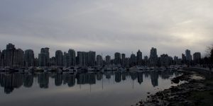
Lab 3: Metro Vancouver: The Potential Effects of a Storm Surge
In this lab, students are expected to analyze the geospatial data to analyze the potential flood risk along the False Creek.